UN
11 Firs Close
£ 480,000
Description
We don't have a Description for this property.
- Bedrooms
- 3
- Bathrooms
- 0
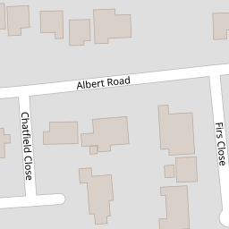

Leaflet © OpenStreetMap contributors
The heatmap indicates the level of crime in the area. The color of the heatmap indicates the crime severity and recency.
Metrics Year-on-Year
- Average area value
- 485,833.00 £Decreased by 9.02 %
- Average area rental value
- 2,833.00 £/moIncreased by 31.77 %
- Est rental Yield
- 7.00 %Increased by 44.93 %
- Crime Rate
- 3.00 %Unchanged by 0.00 %
from 534,023.00 £
from 2,150.00 £/mo
from 4.83 %
from 3.00 %
Nearby Schools
| Name | Type | Ofsted | Distance |
|---|---|---|---|
| Farnborough College Of Technology | Further Education | Outstanding | 0.34 KM |
| Salesian College | Other Independent School | 0.72 KM | |
| St Mark'S Church Of England Aided Primary School | Voluntary Aided School | Outstanding | 0.82 KM |
| South Farnborough Junior School | Community School | Outstanding | 0.94 KM |
| South Farnborough Infant School | Community School | Outstanding | 0.94 KM |
Images
Nearby Streets
| Name | Average Price | Average Sqft | Distance |
|---|---|---|---|
| RAE Road | £ 0 | 0 | 0.00 KM |
| Canterbury Walk | £ 630,000 | 0 | 0.00 KM |
| Church Path | £ 0 | 0 | 0.00 KM |
| Kingsmead | £ 0 | 0 | 0.00 KM |
| Firgrove Road | £ 0 | 0 | 0.00 KM |
Nearby Transport
| Name | NLC | TLC | Distance |
|---|---|---|---|
| Farnborough (Main) | 5521 | FNB | 1.64 KM |
| North Camp | 5636 | NCM | 2.13 KM |
| Farnborough North | 5688 | FNN | 2.15 KM |
| Frimley | 5683 | FML | 3.15 KM |
| Ash Vale | 5547 | AHV | 3.25 KM |
Nearby Listings
| Address | Price | Type | Score | Distance |
|---|---|---|---|---|
| Albert Road, Farnborough, Hampshire | £ 475,000 | BUY | 7 / 10 | 0.10 KM |
| Church Road West, Farnborough, Hampshire | £ 750,000 | BUY | 6 / 10 | 0.13 KM |
| Church Road West, Farnborough, Hampshire, GU14 | £ 550,000 | BUY | 6 / 10 | 0.14 KM |
| Church Circle, Farnborough, GU14 | £ 375,000 | BUY | 7 / 10 | 0.14 KM |
| Church Circle, Farnborough, GU14 | £ 485,000 | BUY | 7 / 10 | 0.17 KM |
Nearby Properties
| Address | Price | Distance |
|---|---|---|
| 2 Firs Close | £ 299,950 | 0.00 KM |
| 8 Firs Close | £ 225,000 | 0.00 KM |
| 7 Firs Close | £ 218,000 | 0.00 KM |
| 3 Firs Close | £ 300,000 | 0.00 KM |
| 15 Firs Close | £ 250,000 | 0.00 KM |